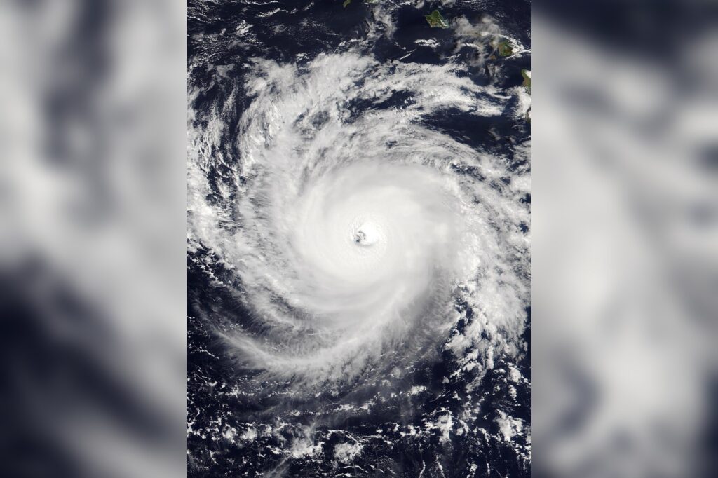
Nothing about the storm changed except its label. Hurricane Nolo crossed the International Date Line on Sunday, October 4, and became Typhoon Nolo, the name for the same kind of cyclone in the western Pacific. Under the hood, the technical reality is plain: the name Nolo stays, and only the regional term for the storm changes.
Nolo was a Category 3 hurricane with maximum sustained winds of 115 mph (185 kph) on Sunday morning Hawaii time, before it crossed the line. By Monday morning Japan time, the Japan Meteorological Agency had it at 100 mph (162 kph), moving west at 19 mph (30 kph).
Why the label changes
The date line sits at 180 degrees longitude and marks the boundary between the central and western Pacific basins. Cross it and the storm’s category of title changes with its geography, not its structure. Tropical cyclones with winds above 74 mph (119 kph) are hurricanes in the northern Atlantic and the central and eastern Pacific, and typhoons in the North Pacific. The South Pacific and Indian Ocean simply say tropical cyclone, whatever the strength.
World Meteorological Organization rules keep the assigned name intact. Forecasting duties shift too, from the Central Pacific Hurricane Center to the Japan Meteorological Agency and the Joint Typhoon Warning Center. The Weather Company noted that precedent is thin but real: Ioke in 2006, Genevieve in 2014 and Dora in August 2023 all made the same crossing.
A long road to this point
Nolo formed as a tropical depression off Mexico on September 13 and dissipated two days later. It returned as what reports called a “zombie storm” and was named Tropical Storm Nolo on September 23. It then passed south of Hawaii, bringing as much as 17.25 inches of rain, flooding and power outages to parts of the state. The storm skirted the islands as a hurricane a week before the crossing, weakened to a tropical storm, and regained hurricane strength on Friday. It reached Category 4 on September 28.
Where it goes next
“The good news is there’s a large, vast ocean, so even though it is still going to be strong, it’s not near any land,” said John Cangialosi, a senior hurricane specialist with the U.S. National Hurricane Center in Miami. AccuWeather meteorologist Jason Nicholls said Nolo should lose intensity gradually as it tracks west through Thursday, then turn north and northeast on Friday and into the weekend. It is expected to pass well east of Japan.
Elsewhere in the Pacific, Hurricane Rachel kept heading west, away from Mexico, while sending dangerous waves and swells toward west-central Mexico and the Baja California Peninsula, according to the hurricane center.
Sources
- Hurricane Nolo crosses International Date Line, becomes Typhoon Nolo
- Nolo changes from a hurricane to a typhoon after crossing the international date line
- Why Hurricane Nolo could become Typhoon Nolo this weekend
Sources
- Hurricane Nolo crosses International Date Line, becomes Typhoon …
- Now it's Typhoon Nolo after Pacific hurricane crosses the …